Property Record
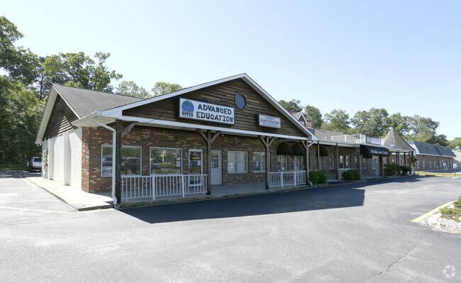
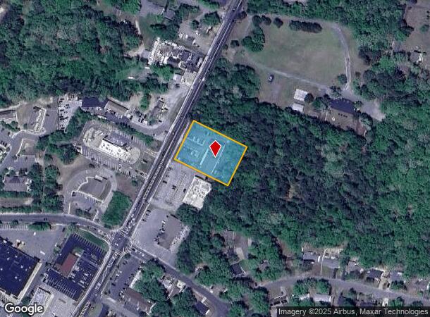
415 No Main St, Lacey, NJ 08731

NEARBY LISTINGS FOR SALE OR LEASE
Property Detail
415 No Main St
New York-Jersey City-White Plains, NY-NJ
Consolidation & Minor
13-00520-0000-00002-02
180 X 250
Commercialnec
Ocean
X
New Jersey
34029C0406F
2.2
2024
1.03 AC
2025
Ocean County
732003
Northern New Jersey
DEMOGRAPHICS near 415 No Main St
1 Mile
3 Mile
5 Mile
2024 Total Population
6,579
34,882
56,854
2029 Population
6,971
37,226
60,752
Pop Growth 2024-2029
+ 5.96%
+ 6.72%
+ 6.86%
Average Age
40
41
41
2024 Total Households
2,289
12,911
21,036
HH Growth 2024-2029
+ 5.55%
+ 6.36%
+ 6.45%
Median Household Inc
$97,104
$91,375
$91,869
Avg Household Size
2.70
2.60
2.60
2024 Avg HH Vehicles
2.00
2.00
2.00
Median Home Value
$330,996
$337,701
$333,929
Median Year Built
1980
1981
1981
Nearby Places
Map Layers
Map Styles
 Street
 Aerial
- Restaurants
- Banks
- Shops
- Fitness
- Groceries
SALE & LEASE HISTORY
LISTING DATE
SALE/LEASE

Jun 21, 2017
For Lease
Nearby Properties
Address
Land Use
TOTAL SIZE
Lot Size
Zoning
Address
Land Use
TOTAL SIZE
Lot Size
Zoning
139.60 AC
M6
Address
Land Use
TOTAL SIZE
Lot Size
Zoning
96.60 AC
R100
Address
Land Use
TOTAL SIZE
Lot Size
Zoning
2,000 SF
94 AC
CR
Address
Land Use
TOTAL SIZE
Lot Size
Zoning
72.26 AC
R100
Address
Land Use
TOTAL SIZE
Lot Size
Zoning
21.34 AC
C200
Address
Land Use
TOTAL SIZE
Lot Size
Zoning
10.49 AC
PURD
Address
Land Use
TOTAL SIZE
Lot Size
Zoning
9,617 SF
14.28 AC
WTB1
Address
Land Use
TOTAL SIZE
Lot Size
Zoning
142,047 SF
18.72 AC
C150
Address
Land Use
TOTAL SIZE
Lot Size
Zoning
4,102 SF
8 AC
HB
Address
Land Use
TOTAL SIZE
Lot Size
Zoning
9.88 AC
C150
Address
Land Use
TOTAL SIZE
Lot Size
Zoning
5,364 SF
16.30 AC
R125
Address
Land Use
TOTAL SIZE
Lot Size
Zoning
28.80 AC
R100
Address
Land Use
TOTAL SIZE
Lot Size
Zoning
960 SF
9.62 AC
R100
Address
Land Use
TOTAL SIZE
Lot Size
Zoning
19.28 AC
MLOF
Address
Land Use
TOTAL SIZE
Lot Size
Zoning
6.14 AC
C150
Address
Land Use
TOTAL SIZE
Lot Size
Zoning
9.45 AC
C200
Address
Land Use
TOTAL SIZE
Lot Size
Zoning
9.65 AC
R-75
Address
Land Use
TOTAL SIZE
Lot Size
Zoning
47,440 SF
6.09 AC
R150
Address
Land Use
TOTAL SIZE
Lot Size
Zoning
8.44 AC
AH10
Address
Land Use
TOTAL SIZE
Lot Size
Zoning
8.76 AC
C150
Address
Land Use
TOTAL SIZE
Lot Size
Zoning
3,840 SF
244.21 AC
CR
Address
Land Use
TOTAL SIZE
Lot Size
Zoning
5.86 AC
AH10
Address
Land Use
TOTAL SIZE
Lot Size
Zoning
5 AC
C200
Address
Land Use
TOTAL SIZE
Lot Size
Zoning
7,200 SF
6.58 AC
CR/
Address
Land Use
TOTAL SIZE
Lot Size
Zoning
6.25 AC
C100
Address
Land Use
TOTAL SIZE
Lot Size
Zoning
6.21 AC
C150
Address
Land Use
TOTAL SIZE
Lot Size
Zoning
2,968 SF
14.08 AC
C150
Address
Land Use
TOTAL SIZE
Lot Size
Zoning
2,800 SF
3.50 AC
HB
Address
Land Use
TOTAL SIZE
Lot Size
Zoning
6,294 SF
4.13 AC
OC
Address
Land Use
TOTAL SIZE
Lot Size
Zoning
7.79 AC
C100
The World's #1 Commercial Real Estate Marketplace
Connect with us
© 2025 CoStar Group
The information above has been obtained from sources believed reliable. While we do not doubt its accuracy we have not verified it and make no guarantee, warranty or representation about it. It is your responsibility to independently confirm its accuracy and completeness. Any projections, opinions, assumptions, or estimates used are for example only and do not represent the current or future performance of the property. The value of this transaction to you depends on tax and other factors which should be evaluated by your tax, financial, and legal advisors. You and your advisors should conduct a careful, independent investigation of the property to determine to your satisfaction the suitability of the property for your needs.